How it works Pricing Airports About
How it works
Services
Pricing Airports About Request a quote

Home › Airports

Business aviation airports in the US, Canada and Mexico

Runways, customs, fuel, weather and local conditions for every airfield we cover, grouped by metro area.

Overview

Skystar publishes a page for every airfield where business aviation operates in the United States, Canada and Mexico, and a page for every metro area that groups them. Each airfield page gathers what an operator checks before a trip: runway length, customs, fuel, operating hours and local conditions, taken from public registers. Each metro area page puts the airfields serving the same city side by side.

A page for every airfield where business aviation operates in the United States, Canada and Mexico, and for every metro area that groups them. Airfield pages cover runways, customs, fuel and hours; metro area pages compare the airfields serving one city.

Busiest airfields for business aviation

By business aviation movements, across the three countries.

Business aviation movements in 2025. Source: FAA TFMSC.

Every airfield we cover appears on its metro area page.

The busiest field is rarely the only one worth weighing. A metro area page lists every airfield within reach of the same city and compares them on runway length, customs, fuel and traffic, so an alternate can be judged on the same terms as the main field.

Business aviation airports by metro area

Airfields in the United States, Canada and Mexico, grouped into metro areas.
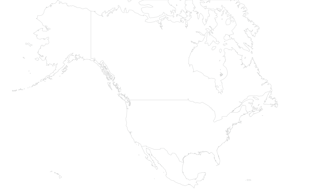
Albany and the Hudson Valley Albuquerque and Santa Fe Aspen and the Roaring Fork Valley Atlanta Austin Bajio Baltimore Birmingham Boise Boston Bozeman and Big Sky Buffalo and Niagara Calgary and Edmonton California Central Valley Canadian Maritimes Canadian North Canadian Prairies Cancun and the Riviera Maya Central Georgia Central Ontario and Muskoka Central Pacific Coast Charleston, South Carolina Charlotte Chattanooga Chicago Cincinnati Cleveland Columbus, Ohio Dallas and Fort Worth Denver Des Moines and Iowa Detroit and Pontiac East and Central Texas Eastern Montana and Wyoming Eastern Washington and Oregon El Paso and Southern New Mexico Great Plains Greenville and Spartanburg Guadalajara Gulf of Mexico Hartford and Springfield Hawaii Houston Huntsville and the Tennessee Valley Indianapolis Interior British Columbia Interior and Northern Alaska Jackson Hole Jacksonville Kansas City Kentucky Knoxville Kootenays and Okanagan Las Vegas Little Rock Los Angeles Los Cabos and La Paz Maine and New Hampshire Memphis Mexico City and Toluca Midland and Odessa Milwaukee and Madison Minneapolis and St. Paul Mississippi Monterrey Montreal Nantucket and Cape Cod Naples and Fort Myers Nashville New Orleans New York Newfoundland North Carolina Triad North Dakota and Western Minnesota North Florida North Texas and the Panhandle Northern Alberta and Peace River Northern California Northern Manitoba Northern Mexico Northern Ontario and Quebec Oklahoma City Omaha Orange County and San Diego Orlando Ottawa Palm Beach and the Treasure Coast Palm Springs and the Desert Panama City and Destin Philadelphia Phoenix and Scottsdale Pittsburgh Portland, Oregon Puerto Rico Puerto Vallarta Quebec City and Saguenay Raleigh and Durham Richmond and Norfolk Rio Grande Valley Rocky Mountains Sacramento Salt Lake City San Antonio San Francisco Bay Area Santa Barbara Savannah and Hilton Head Seattle Sioux Falls South Florida Southeast Alaska Southern Alabama Southern Alaska Southern Alberta Southern Mexico Southwestern Ontario Springfield and the Ozarks St. Louis Sun Valley Tampa and St. Petersburg Telluride and Montrose Texas Border Texas Gulf Coast Tijuana and Baja California Toronto and the Golden Horseshoe Tulsa Upstate New York Vail and Eagle Vancouver Island Vancouver and the Lower Mainland Washington, D.C. West Virginia Western Colorado and Southern Utah Western Virginia and the Shenandoah Wichita Winnipeg

One mark per metro area.

Airfields are grouped by metro area, not by state. A dispatcher serving Manhattan chooses between Teterboro, Westchester, Republic and Essex County, which sit in two states. Each metro area page puts those airfields side by side.

United States
Fuel, operating hours and tower data from the FAA register.
Canada
Customs shown with its entry regime, including restricted ones.
Mexico
No customs or fuel data is published at airfield level, so those sections do not appear.

How airfields are attached to a metro area is set out in our methodology.

Two kinds of page

One airfield, or every airfield around one city.

Answers
Can I land here, and what will it cost?
Which airfield should I use for this city?
Shows
Runways, customs, fuel, hours, traffic, climate, neighbours, our rates.
Every airfield within reach, compared on runway, customs, fuel and traffic, plus seasonality and a worked example.
Open it when
You already know the airfield.
You know the city, not the airfield.
Sections
  • Choosing an airfield here The area in four figures.
  • Comparison Key airfields side by side: runway, customs, fuel, traffic.
  • All airfields Every airfield by distance from the area center.
  • Seasonality How business aviation traffic moves through the year.
  • Rates Our fees, with a trip support request worked through.
  • FAQ Answers specific to this area.

Sections without data do not appear. Smaller airfields show fewer of them.

Every metro area

Each metro area gathers the airfields you would weigh for the same destination, whichever state or province they sit in. Open an area to compare them side by side, then follow any airfield to its own page.
United States

Northeast 8 metro areas · 162 airfields
Albany, Schenectady, Saratoga Springs
Boston 13
Boston, Bedford, Norwood
Buffalo, Niagara Falls, Jamestown
Hartford, Springfield, Windsor Locks
Bangor, Portland, Augusta
Nantucket, Hyannis, Vineyard Haven
Teterboro, White Plains, New York
Busiest: Teterboro
Mid-Atlantic 7 metro areas · 206 airfields
Baltimore, Annapolis, Easton
Philadelphia, Wilmington, Trenton
Pittsburgh, Latrobe, Washington
Richmond, Norfolk, Newport News
Washington, Manassas, Leesburg
Charleston, Huntington, Morgantown
Roanoke, Lynchburg, Blacksburg
Southeast 25 metro areas · 658 airfields
Atlanta 24
Atlanta, Peachtree City, Lawrenceville
Birmingham, Tuscaloosa, Gadsden
Macon, Warner Robins, Milledgeville
Charleston, Mount Pleasant, Summerville
Charlotte, Concord, Monroe
Chattanooga, Cleveland, Dalton
Busiest: Lovell Field
Greenville, Spartanburg, Anderson
Jacksonville, St. Augustine, Fernandina Beach
Lexington, Louisville, Frankfort
Busiest: Blue Grass
Knoxville, Alcoa, Oak Ridge
Busiest: McGhee Tyson
Memphis 40
Memphis, Olive Branch, Millington
Jackson, Meridian, Hattiesburg
Naples, Fort Myers, Marco Island
Nashville, Smyrna, Murfreesboro
Greensboro, Winston-Salem, High Point
Tallahassee, Valdosta, Lake City
Orlando 31
Orlando, Sanford, Kissimmee
West Palm Beach, Stuart, Boca Raton
Panama City, Destin, Fort Walton Beach
Raleigh, Durham, Chapel Hill
Savannah, Hilton Head, Beaufort
Miami, Fort Lauderdale, Opa-locka
Montgomery, Mobile, Dothan
Tampa, St. Petersburg, Sarasota
Texas and Gulf 12 metro areas · 503 airfields
Austin 17
Austin, Georgetown, San Marcos
Dallas, Addison, Fort Worth
Tyler, Longview, Texarkana
Houston 21
Houston, Sugar Land, Conroe
Little Rock, North Little Rock, Conway
Midland, Odessa, Big Spring
New Orleans, Baton Rouge, Houma
Busiest: Lakefront
Lubbock, Amarillo, Abilene
McAllen, Brownsville, Harlingen
San Antonio, Boerne, Seguin
Del Rio, Uvalde, Eagle Pass
Beaumont, Port Arthur, Orange
Midwest 19 metro areas · 831 airfields
Chicago 53
Chicago, Wheeling, Waukegan
Cincinnati, Hamilton, Middletown
Cleveland, Akron, Canton
Columbus, Rickenbacker, Marion
Des Moines, Ankeny, Ames
Pontiac, Detroit, Ypsilanti
Rapid City, Pierre, Aberdeen
Busiest: Lincoln
Indianapolis, Fishers, Greenwood
Kansas City, Olathe, Lee's Summit
Milwaukee, Madison, Waukesha
Minneapolis, St. Paul, Eden Prairie
Busiest: Flying Cloud
Fargo, Grand Forks, Bismarck
Oklahoma City, Norman, Edmond
Busiest: Wiley Post
Omaha 15
Omaha, Council Bluffs, Lincoln
Busiest: Eppley
Sioux Falls, Brookings, Mitchell
Springfield, Branson, Joplin
St. Louis, Chesterfield, St. Charles
Tulsa 27
Tulsa, Broken Arrow, Bartlesville
Wichita 30
Wichita, Newton, Augusta
Mountain West 12 metro areas · 259 airfields
Aspen, Rifle, Glenwood Springs
Boise 13
Boise, Nampa, Caldwell
Bozeman, Belgrade, Livingston
Denver 29
Denver, Broomfield, Erie
Busiest: Centennial
Billings, Sheridan, Gillette
Jackson, Driggs, Afton
Busiest: Jackson Hole
Billings, Missoula, Great Falls
Salt Lake City, Provo, Ogden
Hailey, Twin Falls, Ketchum
Telluride, Montrose, Gunnison
Eagle, Gypsum, Leadville
Grand Junction, Moab, Cortez
Southwest 4 metro areas · 150 airfields
Albuquerque, Santa Fe, Los Alamos
El Paso, Las Cruces, Alamogordo
Las Vegas, Henderson, North Las Vegas
Scottsdale, Phoenix, Mesa
Busiest: Scottsdale
West Coast 11 metro areas · 319 airfields
Fresno, Bakersfield, Visalia
Pasco, Yakima, Wenatchee
Busiest: Coeur d'Alene
Van Nuys, Burbank, Santa Monica
Busiest: Van Nuys
Redding, Chico, Eureka
Santa Ana, Carlsbad, San Diego
Palm Springs, Thermal, Bermuda Dunes
Portland, Hillsboro, Troutdale
Sacramento, Roseville, Stockton
San Jose, Oakland, San Francisco
Santa Barbara, Camarillo, Oxnard
Seattle 28
Seattle, Renton, Everett
Alaska, Hawaii and Puerto Rico 5 metro areas · 185 airfields
Hawaii 15
Honolulu, Kahului, Kona
Fairbanks, Deadhorse, Nome
San Juan, Ceiba, Aguadilla
Juneau, Ketchikan, Sitka
Anchorage, Kenai, Homer

Canada

20 metro areas · 378 airfields
Calgary, Edmonton, Red Deer
Halifax, Moncton, Saint John
Yellowknife, Whitehorse, Iqaluit
Saskatoon, Regina, Prince Albert
Muskoka, Barrie, Orillia
Terrace, Prince Rupert, Smithers
Kelowna, Penticton, Kamloops
Montreal, Saint-Hubert, Mirabel
St. John's, Gander, Deer Lake
Grande Prairie, Peace River, Fort McMurray
Thompson, The Pas, Flin Flon
Busiest: Thompson
Thunder Bay, Sudbury, Timmins
Ottawa 8
Ottawa, Gatineau, Kingston
Quebec City, Saguenay, Trois-Rivières
Lethbridge, Medicine Hat, Brooks
London, Windsor, Sarnia
Toronto, Mississauga, Hamilton
Vancouver, Abbotsford, Victoria
Campbell River, Comox, Powell River
Winnipeg, Steinbach, Brandon

Mexico

12 metro areas · 100 airfields
Bajio 9
León, Aguascalientes, San Luis Potosí
Cancún, Cozumel, Playa del Carmen
Zihuatanejo, Lázaro Cárdenas, Playa De Oro
Guadalajara, Zapopan, Tlajomulco
Veracruz, Tampico, Villahermosa
San Jose Del Cabo, La Paz, Cabo San Lucas
Mexico City, Toluca, Cuernavaca
Monterrey, Apodaca, Saltillo
Chihuahua, Torreón, Durango
Puerto Vallarta, Tepic, Manzanillo
Oaxaca, Tuxtla Gutiérrez, Huatulco
Data last refreshed September 2026. See our methodology →

Questions about the directory

Which airports does Skystar cover?

Every airfield in the United States, Canada and Mexico where business aviation operates and where public registers carry enough to publish a page. Each one has its own page, and each page is reachable from its metro area.

Why are airfields grouped by metro area instead of by state?

Because a trip is planned around a city, not a state line. A dispatcher serving Manhattan weighs Teterboro, Westchester, Republic and Essex County, which sit in two states. A metro area page puts them side by side on the same terms.

How do I find out whether an airfield has customs?

Open the airfield page and read the customs section: it says whether clearance happens on the field and under which regime, and names the nearest port of entry when it does not. The comparison table of each metro area page carries the same information for every airfield in the area.

Why do Mexican airfield pages show fewer sections?

Because the sections follow the data. Customs status and fuel availability are not published at airfield level in Mexico, so those sections do not appear rather than showing an empty table.

Where do the runway, fuel and traffic figures come from?

From public registers and from official traffic records, refreshed on a schedule. Our methodology page sets out each source and how airfields are attached to a metro area.